
North Avondale’s neighborhood boundaries include a shared area with Avondale. The area between Clinton Springs and Glenwood is designated as a “shared area” with both community councils having authority over the area. Throughout the Master Plan process this has seemed to be a point of confusion. This article will present the information we have gathered in the Master Plan update process, but we would welcome any additional clarifications on the history of the North Avondale boundaries.
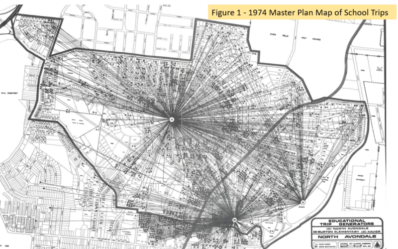
The best explanation of the boundaries for our neighborhood is that it was originally defined by the old North Avondale Elementary neighborhood public school district boundaries. This school was built in 1949 and served as the local school for the community until it became North Avondale Montessori and a magnet school for CPS. In 1966, Burton Elementary School was added to alleviate the overcrowding from the Baby Boomer generation. The 1974 Master Plan contains a map which shows the community for North Avondale and Burton Elementary Schools, as well as Xavier University, and confirms that these boundaries still applied. The map also shows some of the irregular features that we note such as the area behind Mitchell (Kessler Ave.) that is actually part of Clifton, but is part of North Avondale’s community council area (see Figure 1 below). These boundaries were made official by vote of City Council upon approval of the 1974 Neighborhood Master Plan.
This is described in the By-Laws of the North Avondale Neighborhood Association as follows:
“The boundaries of North Avondale shall be congruent with those shown in the map found on page seventeen (17) of the “North Avondale Community Master Plan”, issued in January of 1974 by the Cincinnati City Planning Commission”.
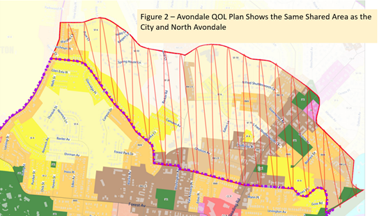
These boundaries are used in our police reports and are contained in the City’s CAGIS Map titled “Cincinnati Community Council Boundaries” which includes the “shared area”. These boundaries are also contained in the Avondale Quality of Life Plan (see Figure 2) which clearly depicts the shared area as the area between Glenwood and Clinton Springs/Dana which is identical to the boundaries used by North Avondale and the City.
In summary, it appears that the boundary for North Avondale goes back to the 1949 North Avondale Elementary School boundaries and was established as the neighborhood council boundary by a vote of Council in approval of the 1974 North Avondale Master Plan (click here to see the 1974 Master Plan). These boundaries are still in use by the police and the City and the current plan offers no changes and should not be an issue of confusion or concern.
Walter Koucky