The work on the North Avondale Master Plan includes a design for future connections for biking and hiking. Two connections were included in the Community Budget Requests (CBR) submitted to the City.
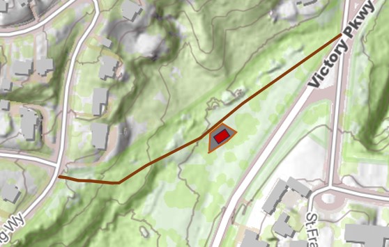
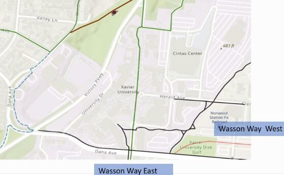
One is a request for a Bike Hike Trail Hub on Victory Parkway near Xavier’s Sports Complex. The Bike Hike Trail Hub would not allow parking but would permit safe access to Wasson Way via Xavier’s campus. This plan would provide a crushed limestone path from Winding Way to Ledgewood through the Victory Parkway greenspace. A shelter or pavilion is also part of this request. An image from this project plan is included below showing the proposed route.

Another connection recommended by Parks and Recreation is the old asphalt path from Fred Shuttlesworth Avenue to the tennis courts and the Recreation Center parking lot. This path would be resurfaced and a gate would be installed to allow pedestrians and bicycles while excluding motor vehicles.
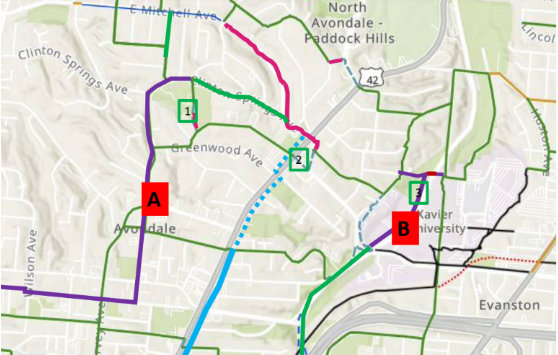
This is part of a larger network in the Master Plan that envisions connections to Clifton’s hospitals, Cincinnati Zoo and UC via Washington and Rockdale Avenues. The overall concept map currently under development for the Master Plan is shown below:

Map Details:
- Numbers 1-3: Bike hubs at North Avondale Recreation Center, Seasongood Square and Victory Parkway. Solar-charging stations have been requested for the North Avondale Recreation Center.
- Letter A: Washington Avenue greenway with a bike lane and enhanced green canopy to Clifton.
- Letter B: North Avondale currently lacks a safe way via bike to downtown. This proposes a bike lane on Victory Parkway to where Wasson Way crosses the Parkway.
- Red Lines: Areas that are currently unsafe for most bicycle riders.
- Green Lines: Calm streets that could be posted for road share. Connecting Dickson from Mitchell to Clinton Springs would be the link to the Washington Avenue route.
- Blue and Dashed Blue Lines: Avondale Greenway, which has been discussed but not yet planned.


